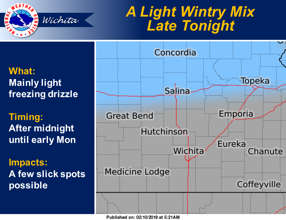
A light wintry mix of precipitation could be the prelude to a mid-week warmup.
A light wintry mix is possible late Sunday night into early Monday morning in areas of central and northern Kansas. By mid-week, though, temperatures are forecast to warm to the 50s.
According to the National Weather Service in Wichita, light freezing drizzle is forecast to develop after midnight Sunday and linger into the early morning hours on Monday. The majority of the precipitation is expected to be light freezing drizzle and is most likely over portions of central and northern Kansas.
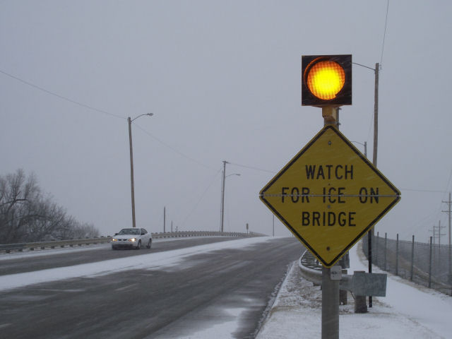
While accumulations will be light, a few slick spots will be possible on untreated or elevated roads. Temperatures may slowly rise to near or just above freezing through the night.
A warming trend is expected as we move through the middle of the week with high temperatures will climbing into the 50s. Another storm system will arrive late in the week, ushering in another shot of cold air.