It remains to be seen if it will go out like a lamb, but March is certainly coming in like a lion. There is the possibility of a couple of hazards beginning Tuesday afternoon. Damaging sustained wind could turn into blizzard conditions by Tuesday night.
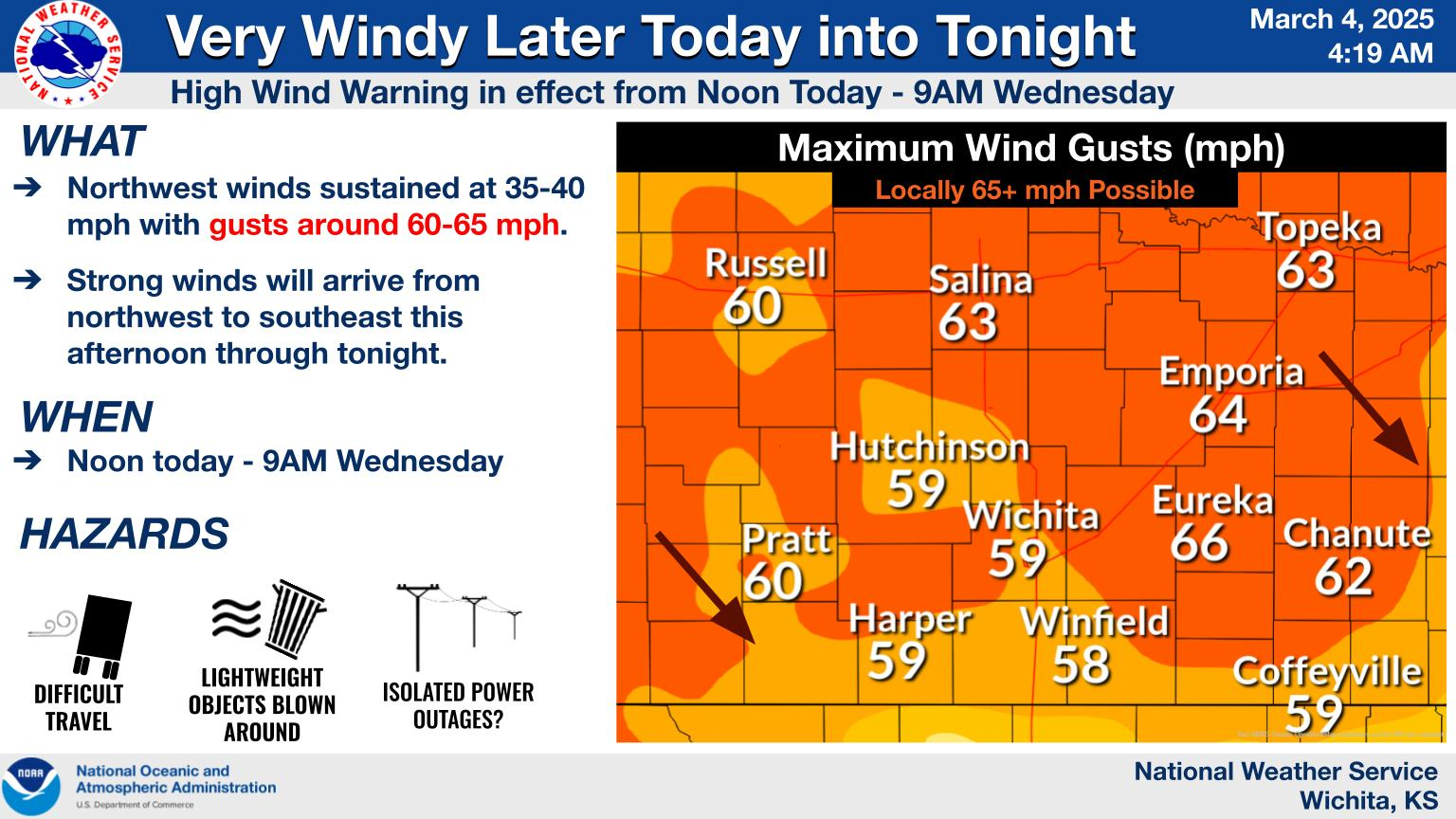
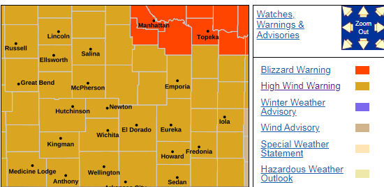
According to the National Weather Service, damaging wind is expected Tuesday afternoon into Wednesday morning. The wind may gust as high as 65 mph across parts of the area. All of Central Kansas is under a high wind warning from noon Tuesday through 9 am Wednesday.
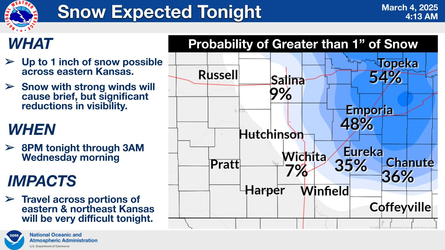
A brief period of moderate to heavy snow is expected Tuesday night across mainly the Flint Hills of east-central Kansas. The combination of snowfall and wind gusts up to 65 mph may create significant visibility reductions and difficult travel conditions. Northeast Kansas will be under a blizzard warning from 8pm Tuesday through 4am Wednesday.
_ _ _
ORIGINAL: It remains to be seen if it will go out like a lamb, but March is certainly coming in like a lion. There is the possibility of multitude of hazards expected to impact the region beginning late Monday evening and continuing through early Wednesday morning.
According to the National Weather Service, multiple hazards will be possible beginning Monday night:
- Strong to severe storms possible across south central and parts of southeast Kansas late Monday evening and into the overnight hours.
- Strong northwest wind is expected to develop on Tuesday afternoon and continue through early Wednesday. Wind gusts of 60-65 mph will be possible.
- A brief period of snow may arrive on the back side of the system Tuesday evening and Tuesday night but colder air may arrive too late for more impactful snow.
A high wind warning will be in effect for the entire area Tuesday afternoon through Wednesday morning.