After breaking a 100-year-old high temperature record on Saturday, a big change in the weather is on the way. Seasonal cooler temperatures have arrived, along with the possibility of severe weather.
According to the National Weather Service, the high temperature Saturday in Salina was 95 degrees breaking the old record of 94 for this date in history set back in 1921.
With the changing weather arriving, storms are expected to develop late Sunday afternoon, and especially overnight across mainly far southern and southeast Kansas. The stronger storms will be capable of nickel to quarter size hail along with 50 to 60 mph winds. Heavy rain and flooding will also be possible with the more intense activity.
Monday looks to be a quiet day weather day across much of Kansas, with a sunny sky and a high in the mid 70s.
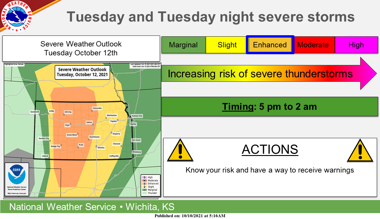
Storms are expected to develop over western Kansas late Tuesday afternoon and track east through Tuesday night. Severe storms will be possible with this activity along with heavy rainfall.
Severe weather in Kansas in the fall is not uncommon. According to the National Weather Service, the primary severe weather season across the United States is considered to be in the spring (March-May), but Kansas also has a secondary severe weather season in the fall. Fall severe weather season typically runs from late September into early November. Just like in the spring, the severity of the fall season varies from year to year and usually is not nearly as intense. However the important thing to remember is that severe weather, including tornadoes, doesn’t just happen in the spring.