High temperatures Sunday and Monday are forecast to be around 60 degrees. That’s the polar opposite of what happened on the same date ten years ago, December 10th and December 11th 2007, the worst ice storm in the history of Kansas.
According to the National Weather Service, this horrific event was caused by devastating, widespread moderate to heavy freezing rain that resulted in equally widespread 1-2 inch ice accumulations. In fact, a few areas were coated by phenomenal 2-4 inch accumulations.
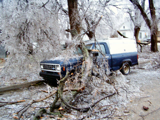
Damage to trees, power lines and power poles was staggering and made any attempt at travel treacherous, if not impossible.
Power outages were, of course, widespread, affecting around 260,000 people. Many areas were without power for 1-2 weeks.
Damage to the electrical infrastructure alone was estimated at $136.2 million, making this the costliest ice storm in Kansas history. Of this total, $37.5 million damage was assessed in Reno County. Such damage involved around 2,000 power poles and 7,900 spans of conductor. Around 5,400 lines and transformers required refusing.
The statewide damage estimate is definitely conservative as most counties did not report their respective monetary losses. Damage estimates to buildings, trees and other foliage was unknown.
Amazingly, no fatalities were reported.
Photo Gallery of 2007 Storm Damage in Salina From KSAL Archives – Click Photos to Enlarge
Copyright © Rocking M Media, 2017. All Rights Reserved. No part of this story or website may be reproduced without Rocking M Media’s express consent.