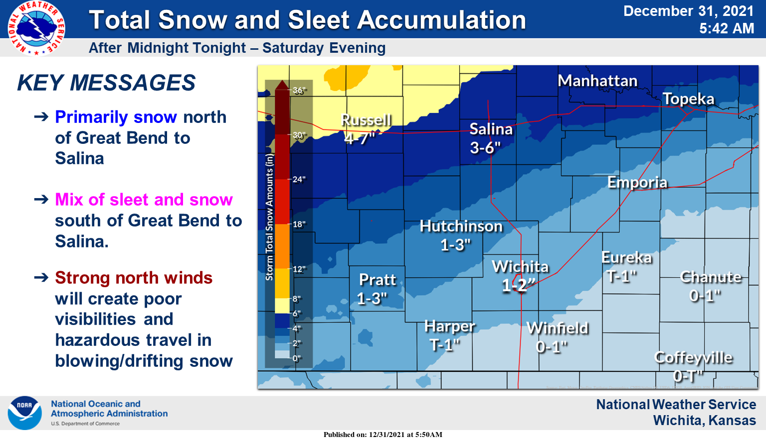
A winter storm will spread a mix of snow, sleet, and freezing rain across the region after midnight New Year’s Eve through Saturday evening. Slick roads and hazardous travel conditions are likely.
According to the National Weather Service, the potential for primarily snow will be north of a Great Bend to Salina, with a mix of sleet and snow south of there. A mix of sleet, snow, and freezing rain is expected across southern and southeast Kansas.
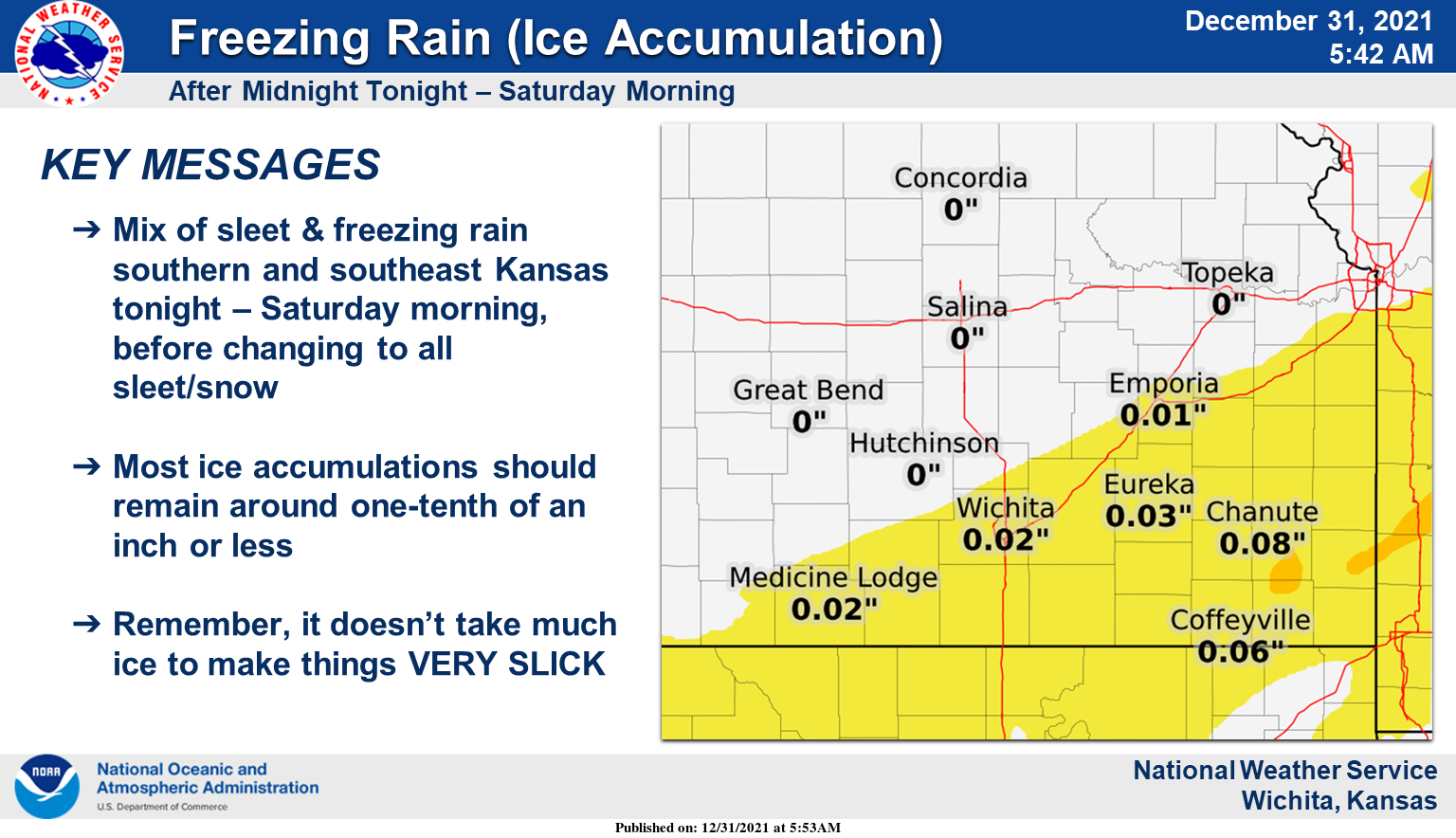
The greatest threat for ice accumulation from freezing rain will be over far southern and southeast Kansas. Accumulations should remain mostly one-tenth of an inch or less. Remember, it does not take much ice to make things very slick.
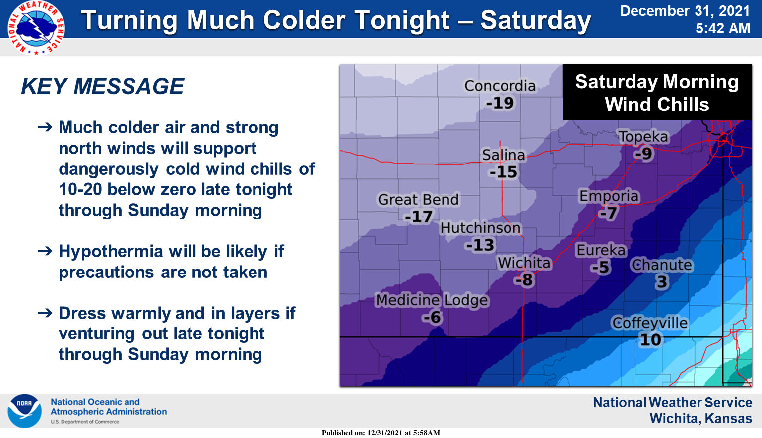
Much colder temperatures and strong north wind will support dangerously cold wind chills late tonight through Sunday morning. Hypothermia will be likely if not dressed appropriately. Dress warmly and in layers if venturing out late tonight through Sunday morning.
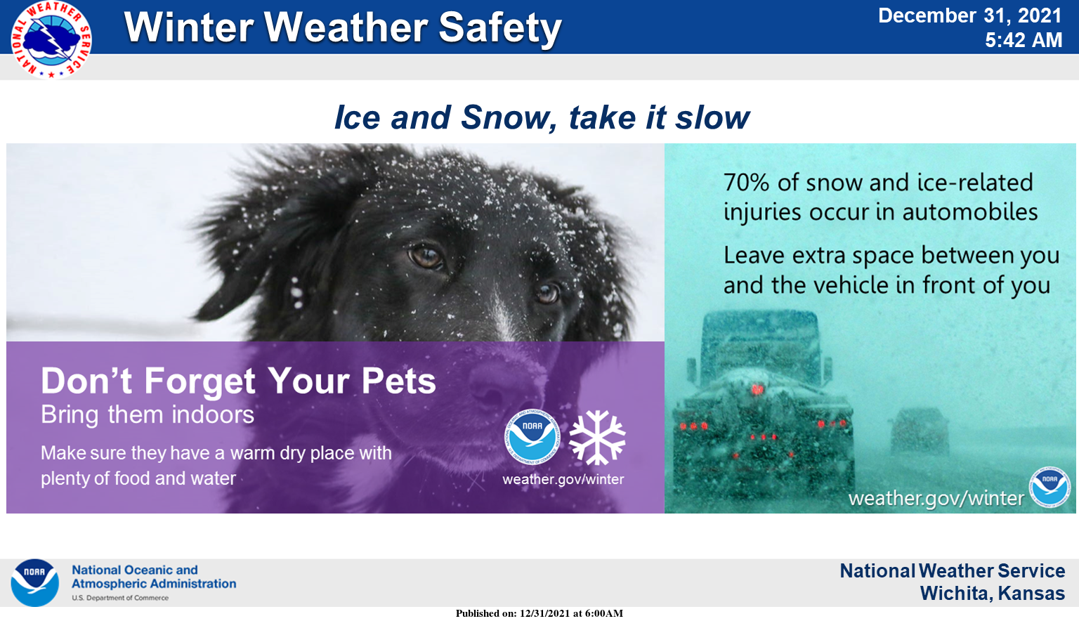
Remember, a majority of winter weather death occur on the road. Also, don’t forget your pets.
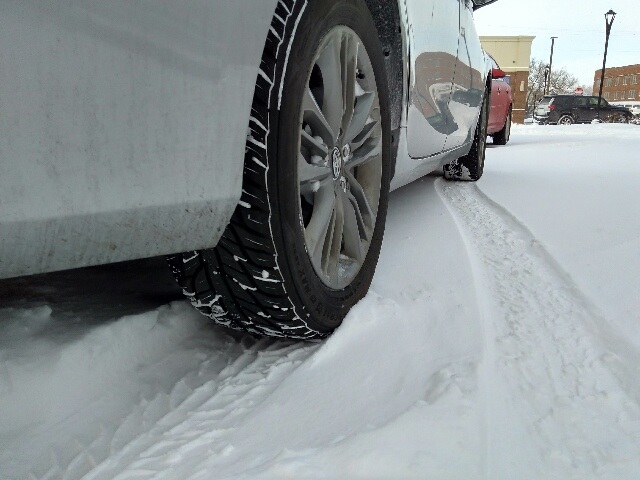
(CLICK PHOTOS TO ENLARGE)