After a couple of mild days inclement winter weather will take over Friday.
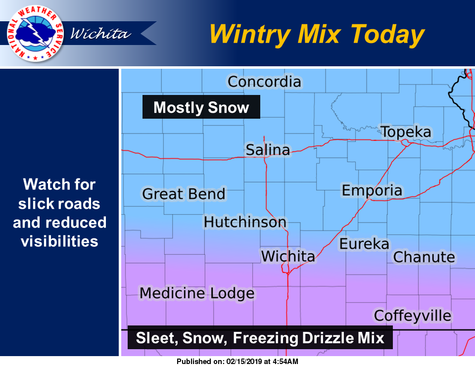
According to the National Weather Service in Wichita, a fast moving storm system will bring snow and a wintry mix to the area starting Friday morning. With temperatures struggling to reach the mid 20s, slick road conditions are likely across the area.
Some sleet and freezing drizzle will also be possible with the snow Friday, resulting in light ice accumulations. Southern KS will see the higher
potential for freezing drizzle.
- Timing: A light wintry mix will expand in coverage after 3 AM across south central KS spreading eastward through the morning hours on Friday.
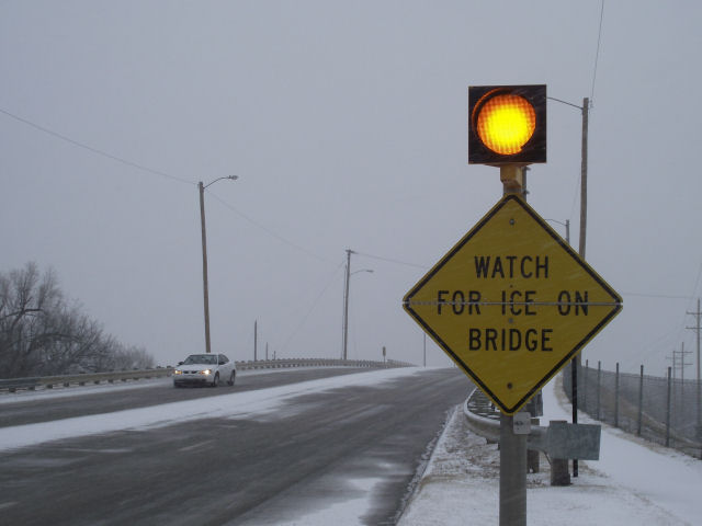
- Magnitude: Ice amounts are expected to remain light, but given temperatures in the mid 20s, slick spots are likely, especially on elevated and untreated surfaces.
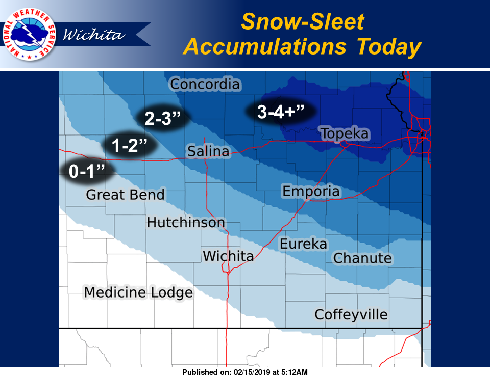
- Location: Light ice accumulations are forecast across much of south central and southeast KS, while snowfall amounts of 1 to perhaps 3 inches will be possible across portions of central Kansas.
- Impacts: Slick roads, bridges, parking lots and sidewalks. Travel delays may occur. Additional layers will be needed.