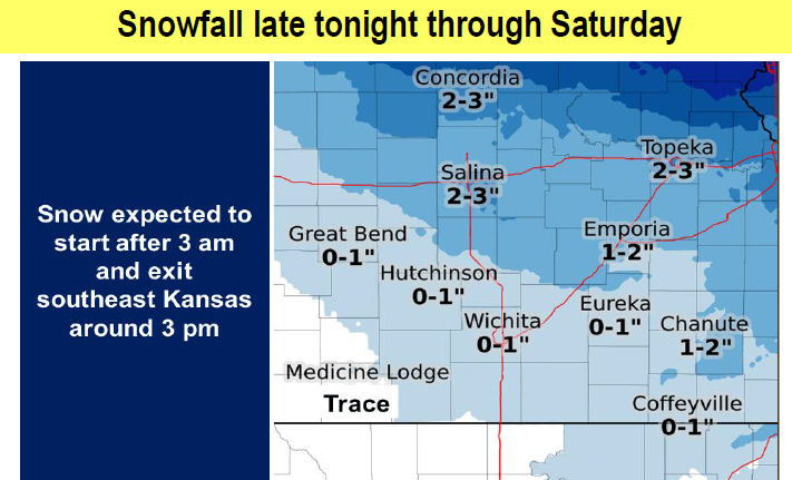
Snow is expected to move into central Kansas late Friday into early Saturday and shift southeast.
According to the National Weather Service, the higher snow amounts will be over central and northeast Kansas where 1 to 3 inches will be possible.
Use caution if traveling on Saturday.
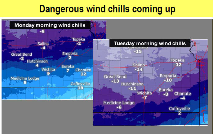
Along with the snow, one of the coldest air masses in several years will overspread the region this weekend and will continue through all of next week and into next weekend.
Morning wind chills will be in the 0 to -15 range for much of the area next week. At this time Tuesday and Wednesday mornings look to be the coldest.
Snow IMPACTS:
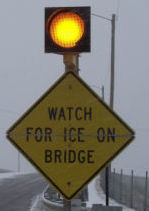
- Untreated roads will become slick with dangerous travel likely across central and northeast Kansas.
Cold IMPACTS:
- Uncovered skin could show signs of frostbite with outdoor exposure especially the extremities.
- Additional layers will be needed.
- Pets need to be brought indoors if they do not have adequate shelter