Tuesday’s severe weather could be the opening act to Thursday’s main event.
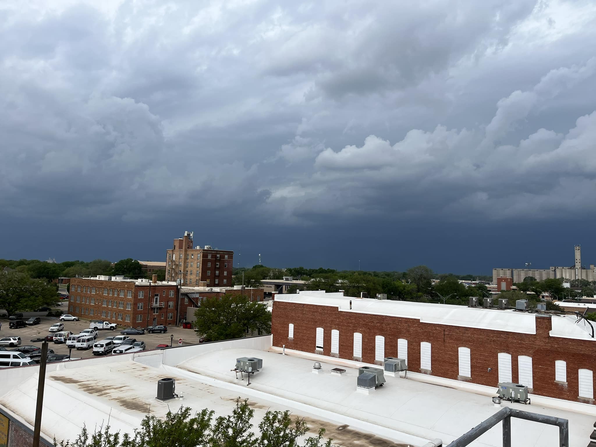
After severe storms rolled across a large portion of Kansas Tuesday afternoon, forecaster say even more significant severe weather is possible Thursday.
Severe Thunderstorms Tuesday brought wind in excess of 80 miles per hour, dropped hail up to the size of ping-pong balls, and dropped heavy rain.
The city of Salina received small hail, and a little over a half inch of rain.
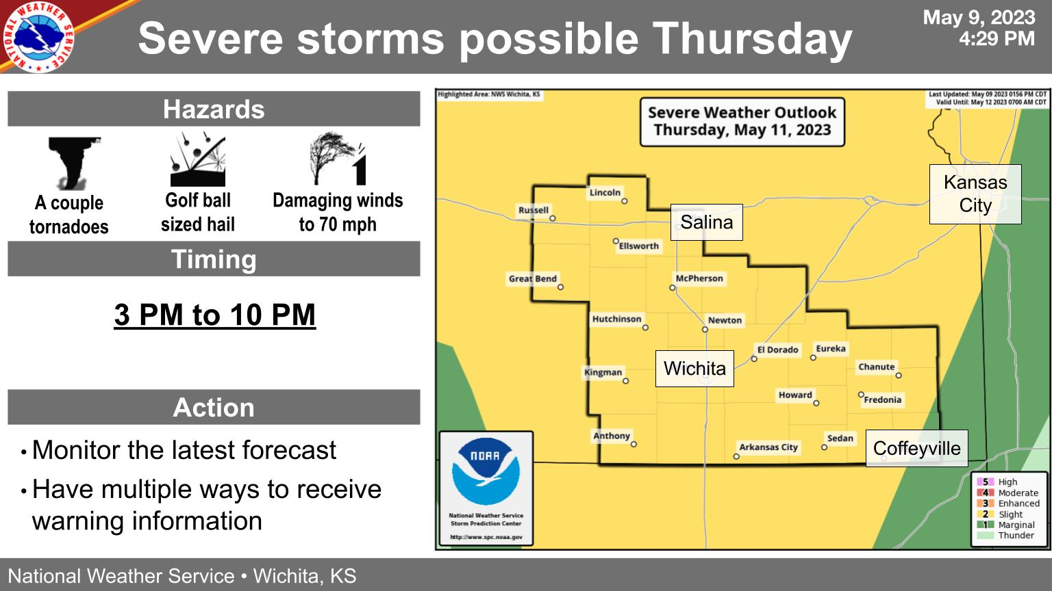
According to the National Weather Service, severe storms are possible again Thursday afternoon into Thursday evening. Severe storms are expected to impact much of Kansas, with the highest threat across the central and south central part of the state. Large hail, damaging wind, and a couple of tornadoes will all be possible.
Everyone is urged to monitor the latest forecast, and have multiple ways to receive warning information.