Severe weather is looming for parts of Kansas later Wednesday and into Thursday.
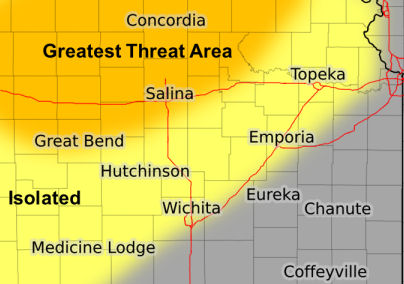
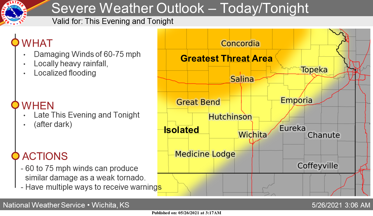
According to the National Weather Service, severe thunderstorms will be possible across Central Kansas late Wednesday evening and into the overnight, as a complex of storms moves east-southeastward off the High Plains. The higher probabilities for severe weather will be along Interstate 70. The expected storm hazards are damaging winds of 60 to 75 mph, heavy rainfall, and localized flooding. 60 to 75 mph winds can produce damage similar to a weak tornado.
Severe storms appear likely on Thursday afternoon across most of southern Kansas. Widespread severe weather may occur with a few higher end severe thunderstorms possible. All facets of severe weather are possible with golf ball to tennis ball size hail, 60 to 70 mph winds and even a few tornadoes.
_ _ _
Wednesday Outlook
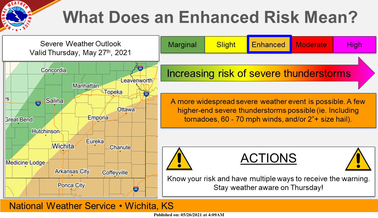
Thursday Outlook