Severe weather could impact graduation activities later on Sunday.
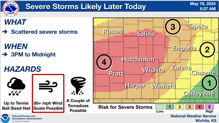
According to the National Weather Service, storms are likely Sunday afternoon through Sunday night with the highest chances of significant severe weather along and west of the Flint Hills.
Forecasters say the main concern will be straight line damaging winds exceeding 80 mph. Up to tennis ball sized hail is possible with any storm that can remain by itself before merging with the line of storms. A couple of tornadoes will also be possible.
Not everyone will experience higher end severe weather; however, the ingredients will be in place for significant damaging winds, especially between I-70 and US-54.
Storm development appears unlikely on Monday for much of the area despite much of the ingredients for severe storms being in place. The best chances to get a couple of severe storms Monday afternoon/night will be along and north of I-70.
Potentially another busy day appears possible on Tuesday with areas along and east of I-135 possibly seeing a few severe storms.