Severe weather rolled through Central Kansas to begin the day Saturday, and there is the potential for more later in the day.
Storms that rolled through the area in the predawn hours Saturday morning dropped large hail and heavy rain, along with 60 mile-per-hour wind. The storms prompted warnings for Lincoln, Ellsworth, and Saline Counties.
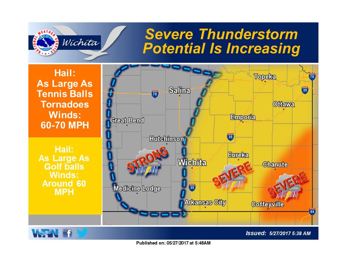
According to the National Weather Service in Wichita, another round of of severe weather is possible later in the day.
the greatest threat for severe weather later in the day Saturday and into Saturday night is in Southeast Kansas. Though that is the area with the greatest threat of severe weather, storms are also possible a little further to the west.
There is still considerable uncertainty as to the exact area and timing of severe weather on Saturday. The risk will ramp up sometime either in the morning or early afternoon and persist into the afternoon or very early evening in Southeast Kansas.
The severe risk is roughly along and east of I-35, with the threat and likelihood of storms increasing towards the southeast corner of Kansas.
If storms wait to develop in the afternoon, the threatened area will likely be limited to areas east of the Flint Hills. Depending on how the storms evolve, the threats could include tennis ball sized hail and 75 mph winds. An isolated tornado cannot be ruled out, however this is not the most likely threat.]