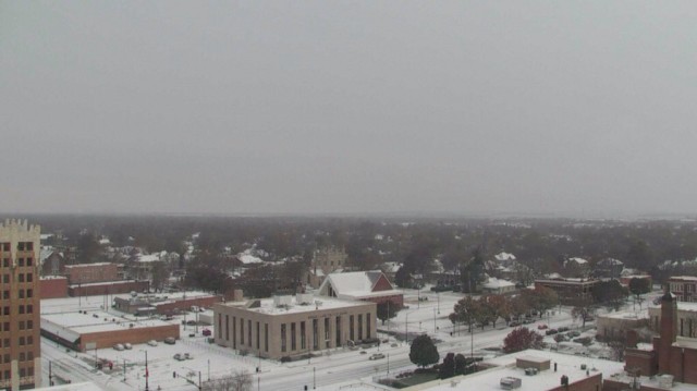
We didn’t have a white Christmas in Central Kansas, but we might have a white New Year,
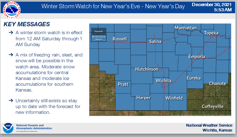
According to the National Weather Service, a winter storm watch is in effect from 12 AM Saturday through 1 AM Sunday. A mix of freezing rain, sleet, and snow will be possible in the watch area, with moderate snow accumulations for central Kansas and moderate ice accumulations for southern Kansas.
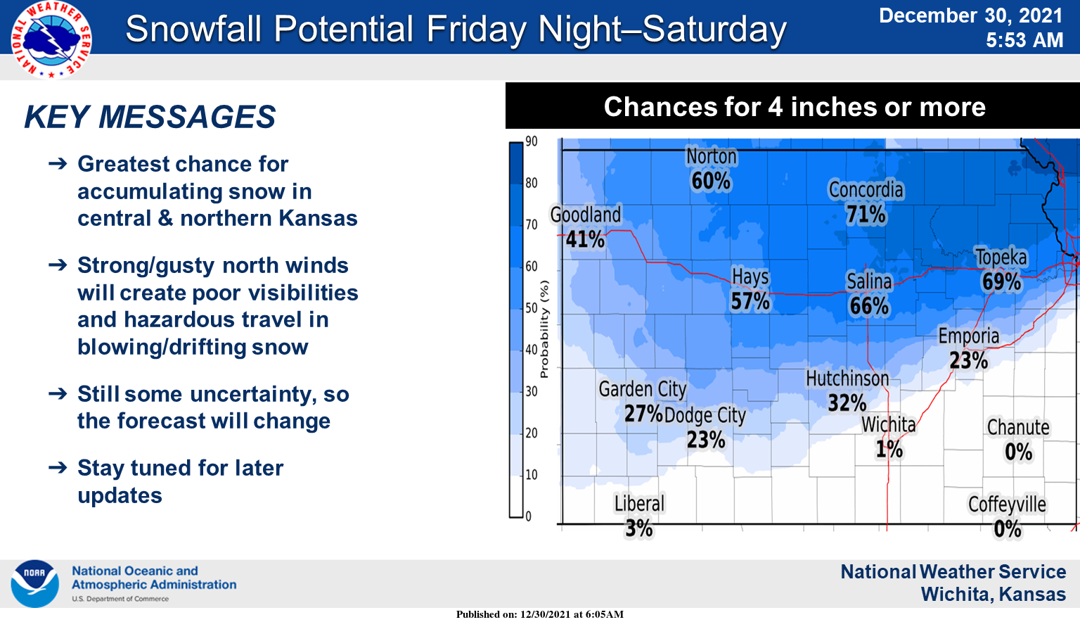
The greatest potential for accumulating snowfall will be generally across central and northern Kansas. Strong and gusty north winds will support blowing and drifting snow, poor visibilities, and hazardous travel conditions.
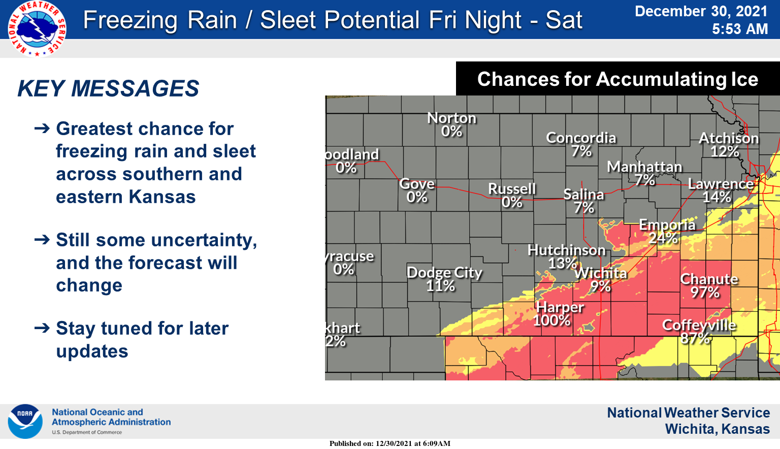
The greatest potential for sleet and freezing rain accumulations late Friday night into Saturday will be across southern and eastern portions of Kansas. Very slick and treacherous travel conditions are possible.
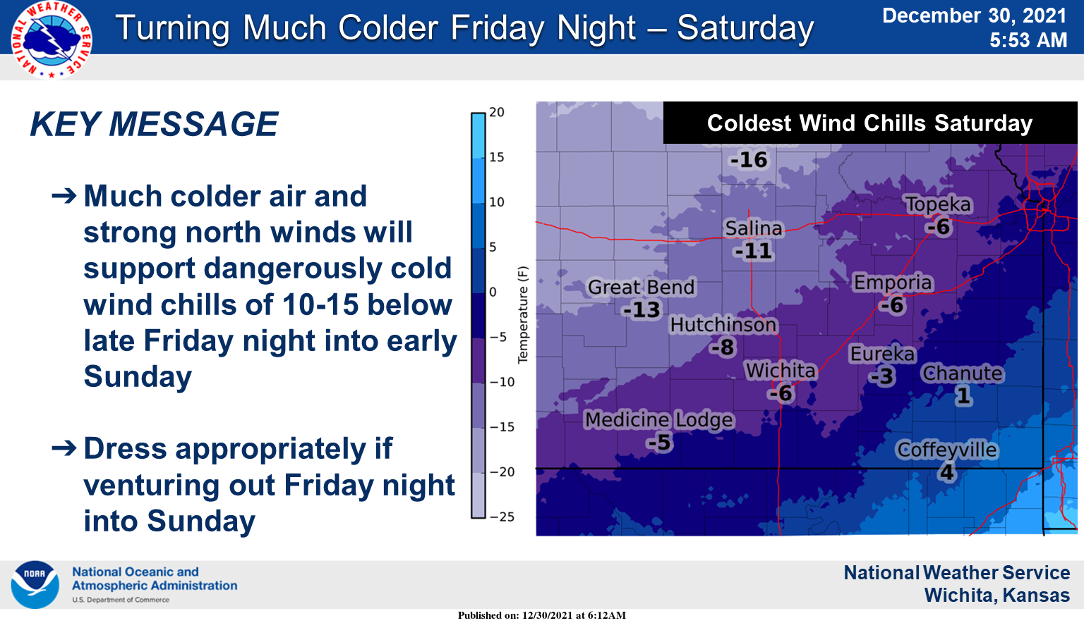
Much colder temperatures and strong north winds will support dangerous wind chills Friday night through Saturday.
The agency advises to dress warmly and in layers if venturing out Friday night and Saturday.
(CLICK PHOTOS TO ENLARGE)