Much needed rain has arrived.
Thunderstorms, some of them bringing heavy rain and small hail, spread across much of Kansas late Sunday night into early Monday morning.
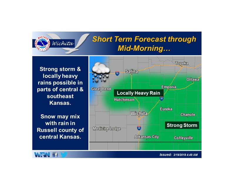
According to the National Weather Service, welcome rainfall is impacting much of the area Monday morning.
A strong storm with small hail and gusty winds will remain possible in southeast Kansas. Locally heavy rainfall can also be expected in southeast and parts of central Kansas. It may also become cold enough for a snow/rain mix in Russell county, though little if any accumulation is expected.
A winter weather advisory is in effect for areas west of Russell County. Up to 3 inches of accumulating wet snow is possible.
—
ORIGINAL: A little drought relief might be on the way, in the form of much needed rain.
According to the National Weather Service in Wichita, scattered showers and thunderstorms will develop late Sunday afternoon and will continue into the overnight hours.
South-central Kansas could see an isolated severe thunderstorm during the overnight hours tonight while areas to the north should only see scattered showers and occasional non-severe thunderstorms.
Rainfall amounts of 0.50 to 1 inch are possible.
The best chance for showers and thunderstorms will be Sunday evening and into the early morning hours Monday.
Last week Kansas Governor Jeff Colyer Tuesday issued drought declarations for the entire state. The declarations includes all 105 counties either in an emergency, warning or watch status.