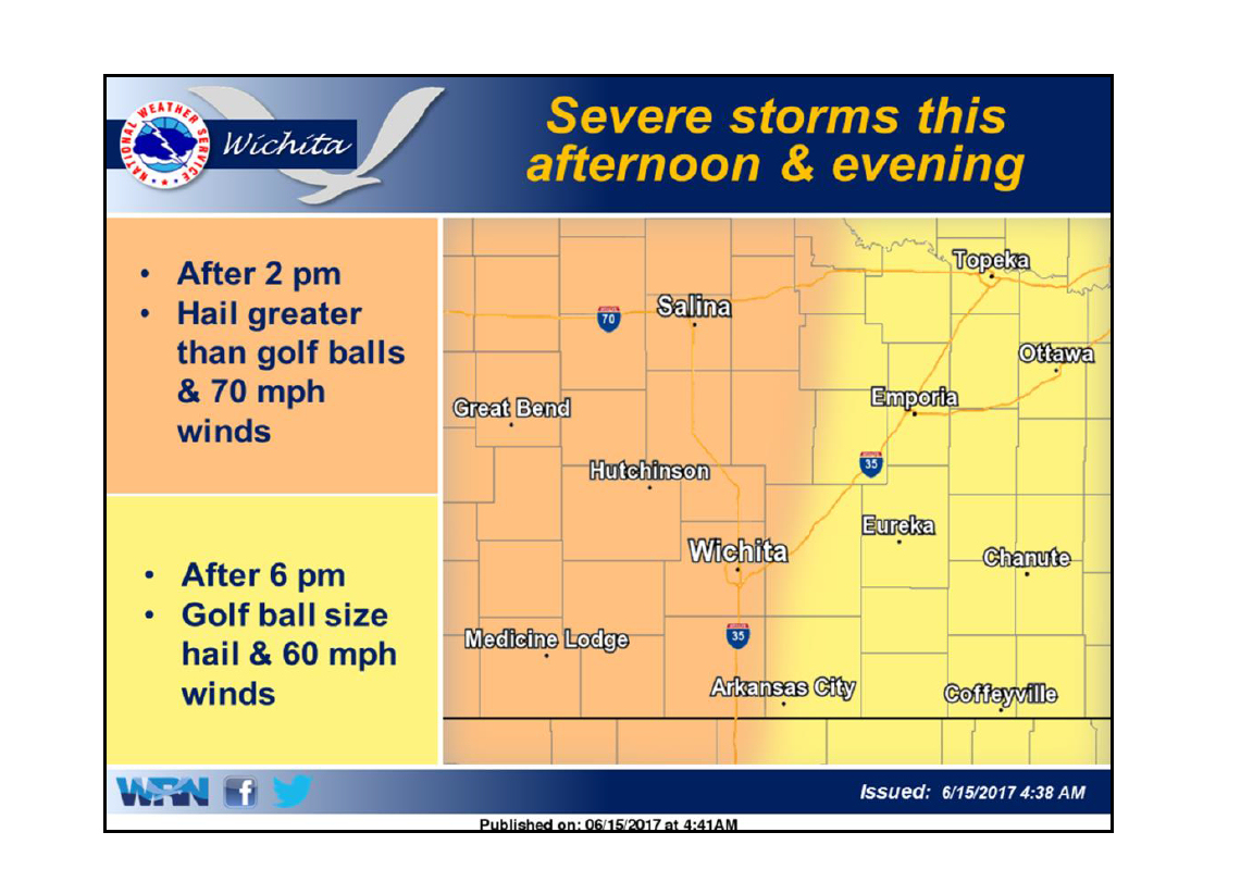
Severe storms capable of producing hail bigger than baseballs and damaging wind in excess of 70-miles-per-hour are possible across Central Kansas late Thursday afternoon into early Thursday evening. The National Weather Service in Wichita hosted a conference call and webinar Thursday morning to discuss the developing weather pattern.
According to the agency, severe storms are likely this afternoon and evening. Storms should first develop west of I-135 after 2 pm and track east and southeast into the evening hours. An area bordering between Hays to Great Bend, to Salina, and to Concordia had the greatest potential for large hail.
Due to an abundance of instability and ample wind shear, confidence is high that very large hail, baseball sized or larger, will be possible with the stronger storms.
Storms should first develop west of I-135 after 2 pm with these storms expected to track east and southeast this evening. Storms are anticipated in the Salina area at around 5:00ish in the evening. Storms will eventually reach southeast Kansas after 8 pm.
Prior to storms developing, there will be dangerous heat across the area with a heat index in excess of 100 degrees.