A week-long heatwave which shattered record highs across the area is set to end. After another day of dangerous extreme heat on Friday, forecasters say it will be cooler over the weekend, and into next week.
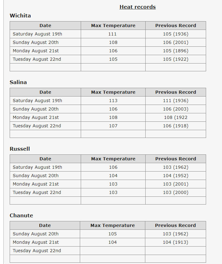
According to the National Weather Service, a week long heat wave has impacted most of the Southern and Central Plains as an upper level high pressure system planted over the region. This feature provided 7 consecutive days of extreme temperatures. Through this time period, 14 max temperature records were either tied or broken across the Wichita NWS forecast area.
In Salina, record high temperatures were established four days in a row, Saturday though Wednesday.
The dangerous heat in Central Kansas will continue one more day, on Friday, with heat indices near 105. Continue to take safety precautions to protect yourself from the heat. Highs look to be closer to normal, in the low to mid 90s, beginning Saturday. There will also be a few chances for storms this weekend with the best chances across central Kansas.