With the coldest air of the season so far, an overnight low in Salina early Saturday morning of 34 degrees, there was some patchy frost around the area.
According to the National Weather Service, frost occurs when there is a solid deposition of water vapor from the air. Frost will form when solid surfaces are cooled below the dew point. An air temperature range of 33°- 36°, along with very light winds, is usually needed to initiate frost formation. At least minor damage is possible to plants.
The range of average dates for the first fall frost across most of south central Nebraska and north central Kansas is between Sep. 24 – Oct. 8.
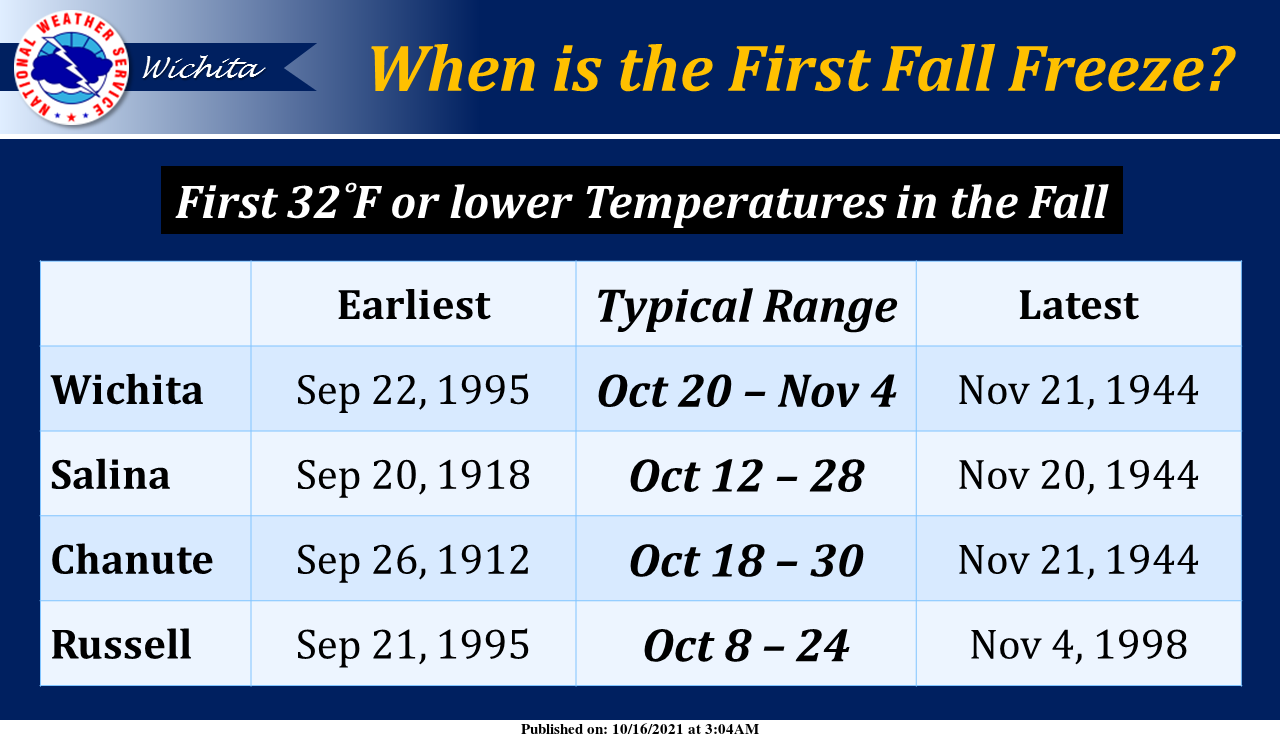
Freeze occurs when the temperature drops to 32°-or-lower. A freeze will result in significant damage to many unprotected plants, especially if the temperature remains at-or-below freezing for several hours.
The range of average dates for the first fall freeze across most of
south central Nebraska and north central Kansas is between Oct. 1 – Oct. 16.
Hard freeze occurs when the temperature reaches 28°-or-lower for at least a few hours. It usually means that many types of plants and most seasonal vegetation will be destroyed.
The range of average dates for the first hard freeze of the fall across most of South central Nebraska and north central Kansas is between Oct. 9 – Oct. 26.
According to the agency, the earliest fall freeze on record for Salina is September 20th, 1918. The latest fall freeze on record is November 20th, 1944.
_ _ _
Photo by Ross Sneddon via Unsplash