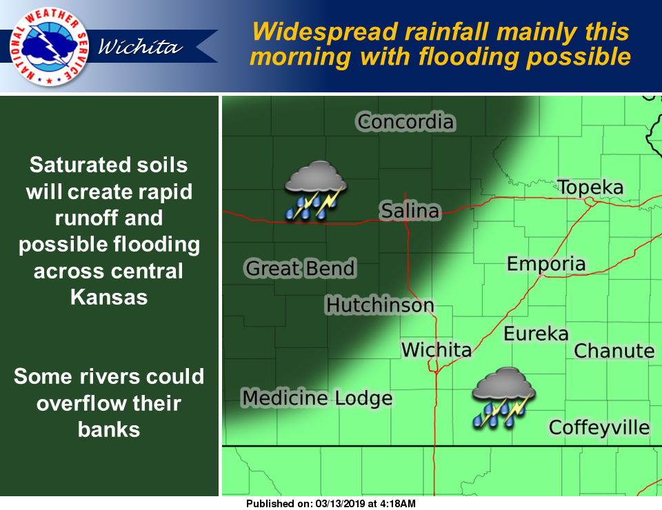
It could be day of of weather of extremes around the area. Flooding rain and damaging straight line wind are possible.
According to the National Weather Service, widespread rain will move across the region mainly in the morning with some flooding possible over central Kansas. In addition, rivers are running higher than normal in central Kansas and could begin to overflow their banks. A flood watch remains in effect for central Kansas through Wednesday evening.
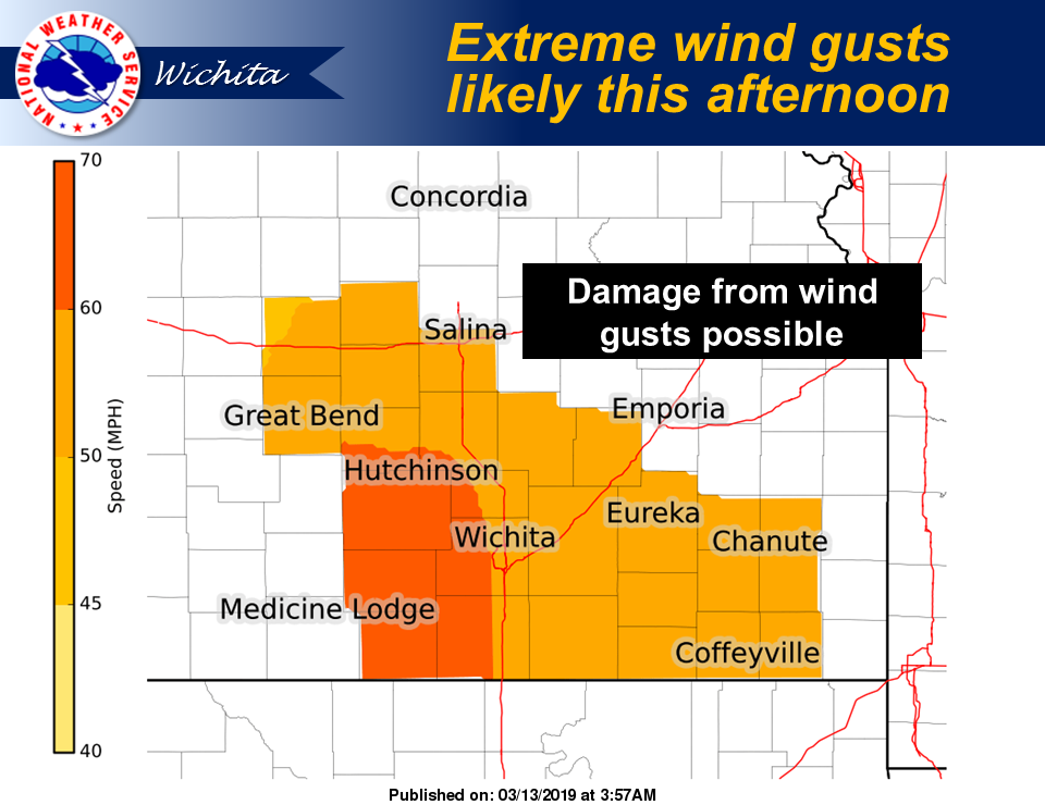
Along with the rain, extreme wind gusts will affect much of the region Wednesday afternoon into the early evening with gusts up to 60 mph possible. South wind gusts will increase to possible extreme levels for this afternoon and evening. Please take precautions for any light weight outdoor items that could be blown away or damaged by winds gusts around 60 mph. In addition, the extreme south winds will elevate the grassland fire danger to extreme levels today.
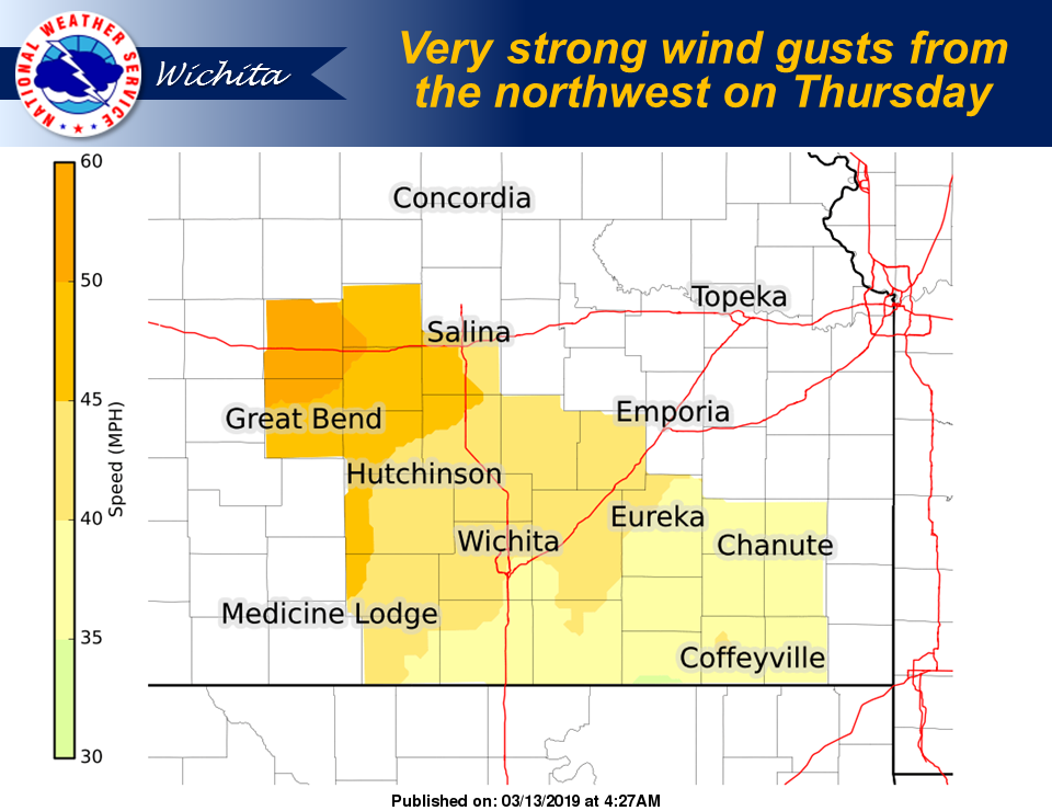
Very strong wind gusts are expected again on Thursday but will be from the northwest.
A high wind watch is in effect for central Kansas with gusts over 55 mph possible.
(CLICK IMAGES TO ENLARGE)