It could be a wet and wild Father’s Day Sunday. Forecasters anticipate severe weather across much of Central Kansas.
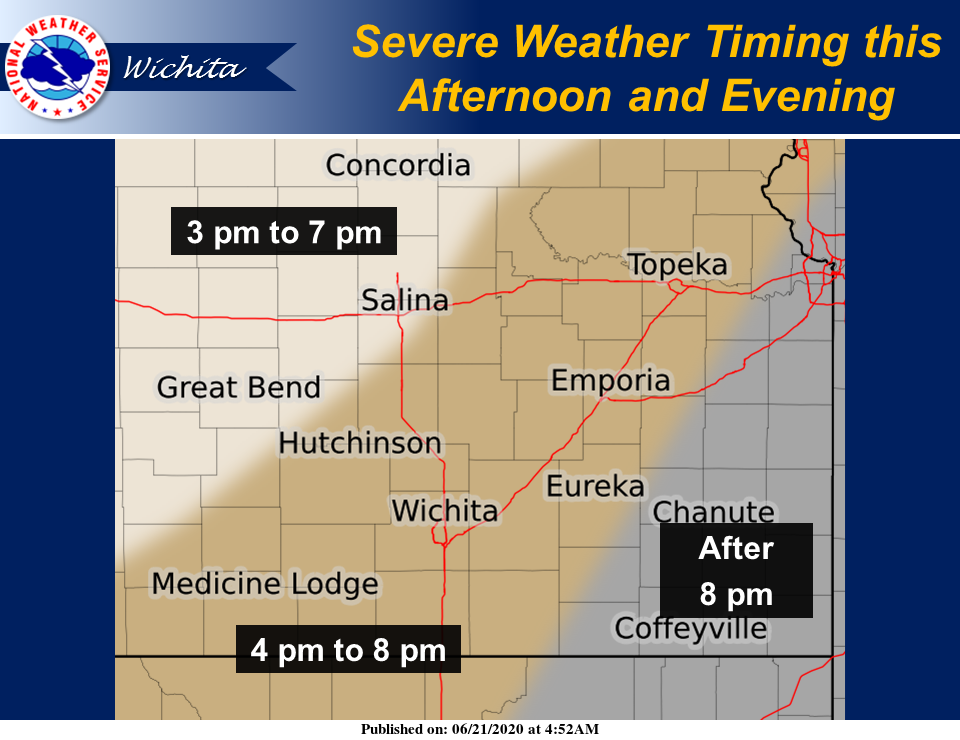
According to the National Weather Service, severe thunderstorms are likely to develop in the mid to late afternoon. They strongest severe weather will be with the initial development.
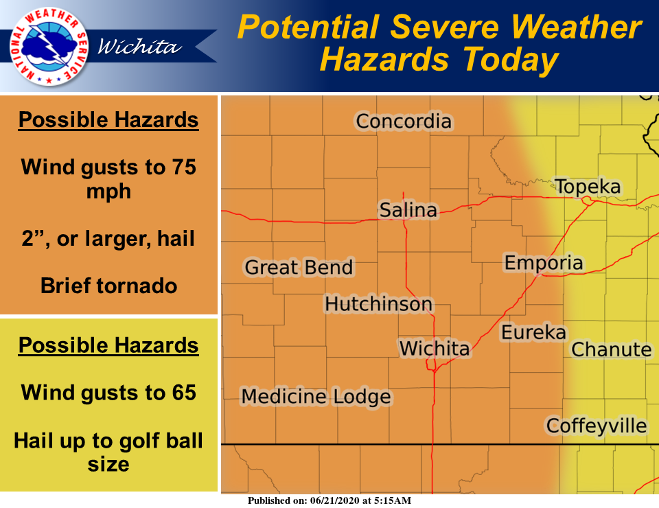
Severe storms will develop in the west, with 2 inch hail and isolated tornadoes possible in the initial development.
By late afternoon/evening (4- 7pm), the main threat will shift to high winds (up to 70mph), very heavy rain, and isolated flooding.
Central Kansas will have the greatest chance for the high end severe weather. The wind and flooding threat will be along and east of I-135.
IMPACTS:
• Hail and high winds may damage roofs, windows and siding
• Large hail and damaging winds may damage crops
• Damage is likely to mobile homes, roofs and outbuildings
• Weak tornadoes can take the roofs off buildings and break windows
and tree limbs.
• Stronger tornadoes can level buildings and snap large tree trunks near
ground level.
• Creeks and streams will overflow banks causing flooding of adjacent
roads and land
• Hydroplaning may occur with water on roads
• Torrential rainfall will cause low visibilities while driving
• Roads may be washed out