The same storm system that produced 100 MPH wind in Salina also produced at least 4 tornadoes across Kansas and a derecho which caused widespread damage in south central Kansas.
The National Weather Service is rating two tornadoes that touched down in central Kansas. An EF-one tornado struck northwest of Russell on Sunday night and remained on the ground for 10 minutes. A second EF-one tornado touched down northeast of Wilson and stayed on the ground or about five minutes.
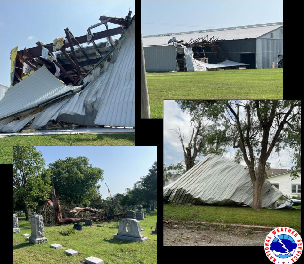
According to the weather service, Sunday’s storms also produced straight-line wind from a derecho, which caused widespread damage in Harvey County in Burton, Halstead, and Newton. A derecho is a long lived and damaging thunderstorm. A storm is classified as a derecho if wind damage swath extends more than 240 miles and has wind gusts of at least 58 mph or greater along most of the length of the storm’s path.
Further east two tornadoes also touched down in Johnson County. An EF-one tornado struck south of Mill Valley High School, and a second EF-one tornado touched down in northeastern Johnson County during Sunday night’s storms. The tornadoes caused widespread damage, but no injuries were reported. Several schools in that area were closed Monday for cleanup.
Kansas Governor Laura Kelly is issuing a state of disaster emergency in the aftermath of Sunday’s storms. The declaration activates the Kansas Response Plan and expedites state assistance to communities impacted by the severe weather. Sunday’s storms produced tornadoes in central and eastern Kansas and damaging straight-line winds.
_ _ _
Photos via National Weather Source