The calendar indicates we are in the middle of spring, but you won’t know it this weekend across Central Kansas. A strong low pressure moving into the plains this will bring much cooler temperatures, lots of rain, and maybe even a little snow.
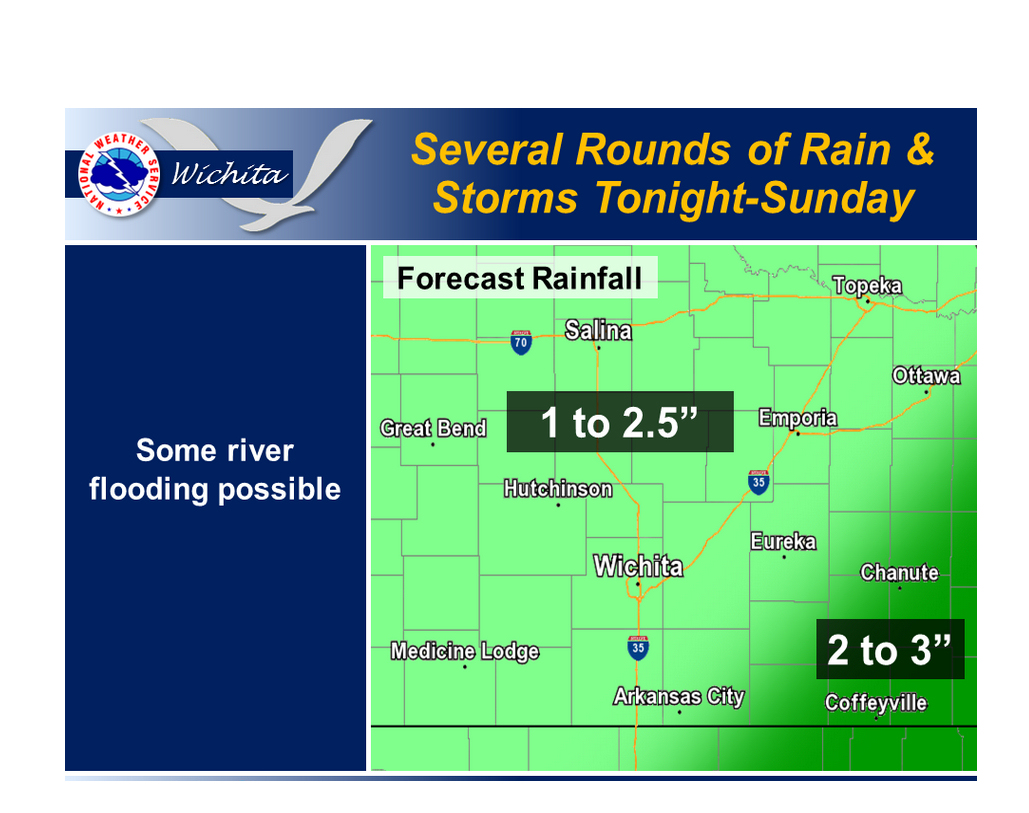
According to the National Weather Service, a strong storm system will spread several rounds of rain and thunderstorms across the region through Sunday night. The primary threat will be heavy rainfall. Some minor river flooding is possible across the area.
Forecasters are calling for the heaviest rain to come through Kansas Saturday and into Sunday. Snow is expected west of an area from Hays to Dodge City.
—
Salina Forecast:
- Tonight – Showers likely, mainly after 3am. Cloudy, with a low around 44. Breezy, with a north wind 11 to 16 mph increasing to 17 to 22 mph after midnight. Winds could gust as high as 29 mph. Chance of precipitation is 70%.
-
Saturday – Showers and possibly a thunderstorm. High near 46. Breezy, with a north wind 22 to 24 mph, with gusts as high as 31 mph. Chance of precipitation is 100%.
-
Saturday Night – Showers and possibly a thunderstorm before 1am, then showers likely. Low around 39. Breezy, with a north wind 15 to 23 mph, with gusts as high as 30 mph. Chance of precipitation is 80%.
-
Sunday – Rain. High near 43. Breezy, with a northwest wind 17 to 20 mph, with gusts as high as 28 mph. Chance of precipitation is 80%.
-
Sunday Night – A 50 percent chance of rain, mainly before 1am. Cloudy, with a low around 37. Breezy, with a west northwest wind 18 to 21 mph, with gusts as high as 30 mph.
-
Monday – Mostly sunny, with a high near 62. Breezy.
]