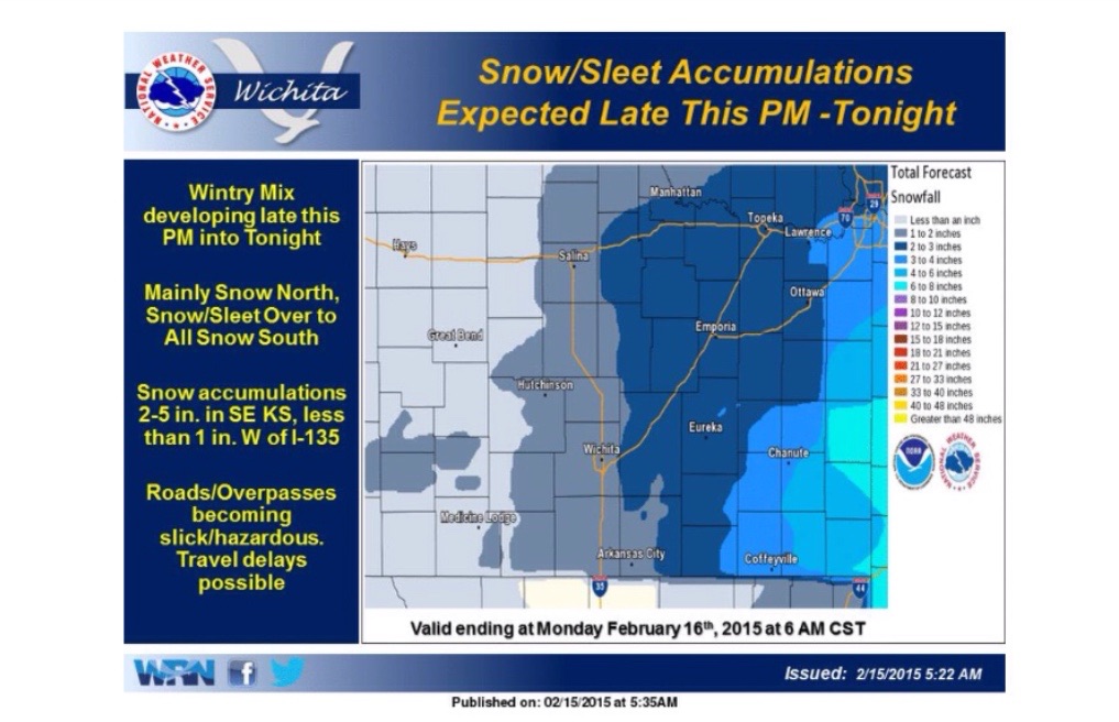
Snow and ice are on the way to parts of Kansas.
According to the National Weather Service, a storm system will track across the region late Sunday afternoon into Sunday night, producing a wintry mix across the area.
Mainly snow is expected across the north, with a mix of light snow, sleet, and freezing rain in the south transitioning to all snow overnight.
Total snowfall accumulations by monday morning are expected to range from 2 to 5 inches generally east of Interstate 135, and 1 inch or less west of I-135.
Only a trace of ice accumulation is possible near the Oklahoma border late Sunday afternoon and evening. Roads and overpasses may become slick and hazardous for travel, especially along/east of I-135 due to snow and sleet accumulations.