More winter weather is on the way.
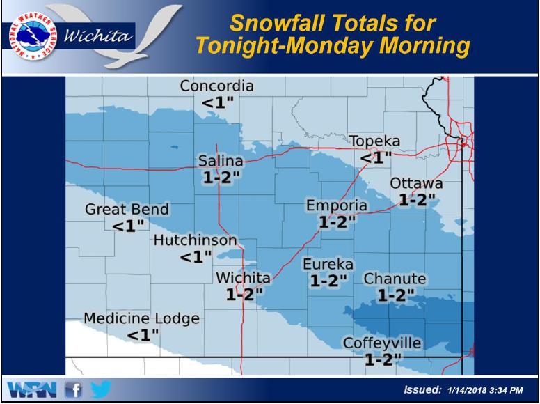
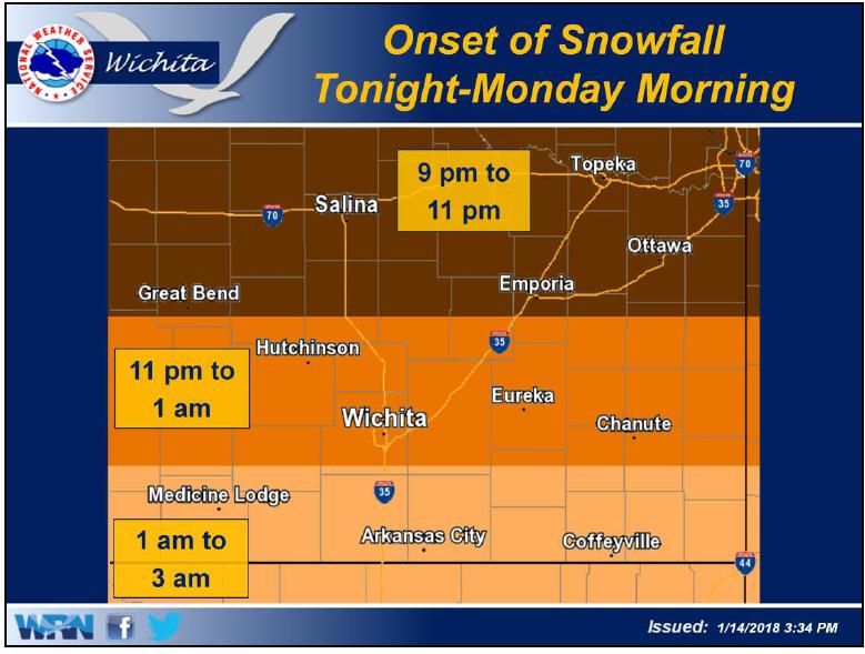
According to the National Weather Service in Wichita, light snow will develop behind a cold front and make its way southward across the area late Sunday night and into Monday morning. Snow will diminish from north to south during late morning or early afternoon.
Average snowfall amounts of 1-2 inches will be common with locally higher amounts possible.
Temperatures are expected to fall through the day on Monday as gusty north winds usher in much colder air. By 3 PM, temperatures will be in the teens across much of eastern Kansas.
Dangerous wind chills are expected Tuesday morning. Values of 15 to 20 below will be common for much of the area. Remember to dress in layers. Cover exposed skin to reduce your risk of frostbite and hypothermia.
But there is light at the end of the tunnel. A warming trend is forecast for the end of the week. By Saturday, forecasted highs will be in the upper 40s to lower 50s.