A Google Street View car was seen roaming the streets of Salina Tuesday taking photos.
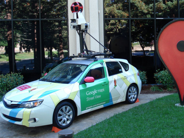
Cars in Google’s Street View fleet have 15 lenses taking 360 degrees of photos. Motion sensors track the camera’s position, a hard drive stores the data, a small computer runs the system and lasers capture 3D data to determine distances within Street View imagery.
Google’s cars are mapping cities around the country. The cars started driving in the southern states and move north as it gets warmer.
When data goes back to Google, signals from several sensors in the car, like GPS, determine the car’s exact locations. When the signal is blocked by a tall building, data from other sensors help fill in the gaps