Part of Kansas are preparing for a snow storm.
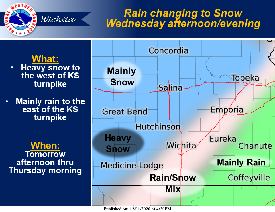
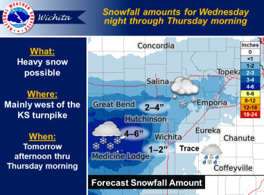
According to the National Weather Service, snow is expected from Wednesday afternoon through Thursday morning. Heaviest amounts will occur west of the Kansas turnpike, with a sharp cutoff in snow amounts due to a rain/snow transition line setting up roughly parallel to the turnpike.
A changeover to snow will occur across central and portions of south central Kansas Wednesday afternoon, from northwest to southeast. The rain-snow transition line is forecast to set up about parallel to the Kansas turnpike and will impact timing and accumulations in the vicinity. Any east or west shift may significantly change forecast snowfall accumulations.
The heaviest snowfall will occur mainly across South Central Kansas and portions of Central Kansas.
Travel will become difficult Wednesday evening. Possible impacts include:
- Untreated roads will become slick.
- Slick roads, bridges, parking lots and sidewalks. School closings and delays area likely.
- Possible adjustments to government operations.
Most of the snow will end by Thursday morning.