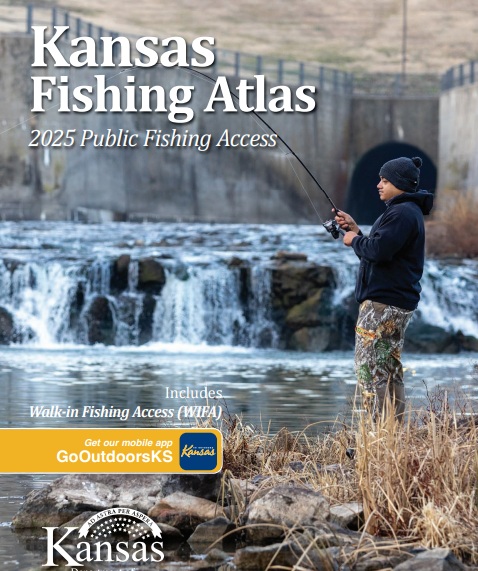
The new Kansas Fishing Atlas which came out this week has a local connection to it, the cover photo is a young man from Salina fishing, taken by a Salina photographer.
Tanner Colvin shot a photo earlier this year of Thomas Humphrey fishing at Outlet Park below the dam at Kanopolis State Park. Colvin submitted the photo, and a story, to the Kansas Department of Wildlife and Parks for use. Though the organization did not use the story, they did use the photo for the cover of their 2025 Kansas Fishing Atlas.
The Kansas Fishing Atlas is a resource published by the Kansas Department of Wildlife and Park that maps public fishing areas and public lands across the state, including Walk-In Fishing Access (WIFA) areas, federal reservoirs, state fishing lakes, river access areas, and community lakes.
The Kansas Fishing Atlas includes:
- Maps of Public Fishing Areas. The atlas features maps pinpointing various public fishing areas and public lands across Kansas.
- Walk-In Fishing Access (WIFA) Areas. These are privately-owned ponds or streams that the KDWP has leased and opened to public fishing.
- Federal Reservoirs. All federal reservoirs are marked on the maps.
- State Fishing Lakes. All state fishing lakes are also included.
- River Access Areas. The atlas shows river access sites.
- Community Lakes. Impoundments owned by cities or counties are also mapped.
- Information on Reading the Maps. The atlas provides guidance on interpreting the maps and understanding the symbols used.
- Other Information. It includes general information about Kansas fishing regulations and other relevant details.
A hard copy of the Kansas Fishing Atlas is available at Kansas Department of Wildlife and Parks offices, and where fishing licenses are sold. You can obtain a copy of it via a PDF download.
_ _ _