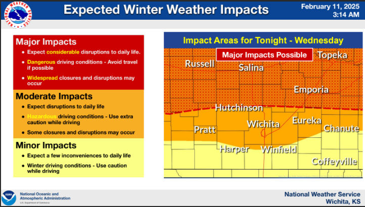
A winter storm will arrive late Tuesday night into Wednesday with snow accumulation expected across the entire state.
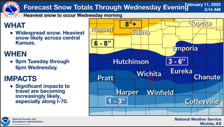
According to the National Weather Service, widespread snow is anticipated, with the heaviest snow likely across central Kansas. The highest totals continue to be expected along and north of Interstate 70, where up to 8 inches and even greater are possible.
Significant impacts to travel are becoming increasingly likely, especially along I-70.
According to Saline County Emergency Management, residents should prepare for considerable disruptions to daily life, dangerous driving conditions, and widespread closures and delays.
Wind gusts of 25 to 30 mph could lead to drifting snow, further complicating road conditions. Significant travel disruptions are likely, especially along I-70. Employers are encouraged to consider delayed start times or remote work where possible to reduce traffic and allow road crews to clear streets effectively.
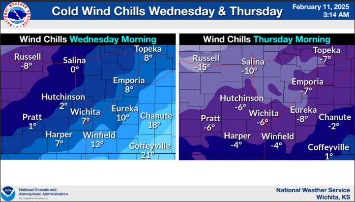
Bitterly cold wind chills are expected Wednesday and Thursday mornings with values as cold as 18 below.