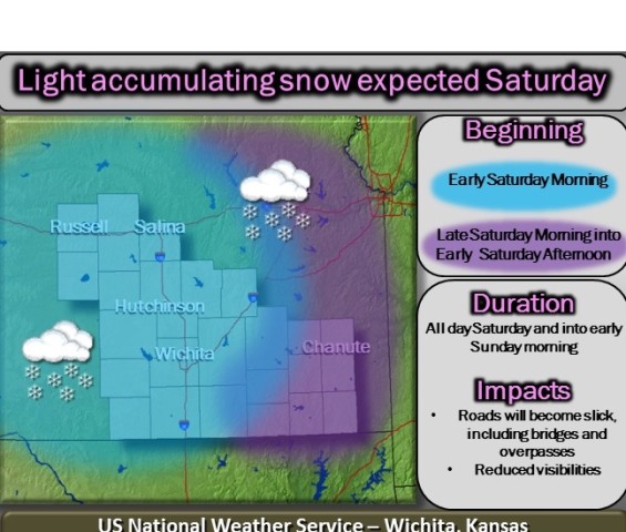
The first round of snow this season is expected to blanket a large area of Kansas this weekend, with the heaviest snow expected in portions of Central Kansas.
According to the National Weather Service in Wichita, light accumulating snowfall is expected to begin early Saturday morning across central Kansas and spreading eastward throughout the morning and afternoon. Current snowfall accumulations expected to be 1-3 inches south of Highway 54 and 2-4 inches north of Highway 54. Snow should taper off Saturday night, but light snow will return briefly Sunday morning.
The National Weather Service Topeka bureau says much of the area is very likely to receive 1-4 inches of snow by sunrise on Sunday, while a band of 4 or more inches may develop from central into eastern Kansas.
The bulk of the snow will fall during the day on Saturday with another round of light snow on Saturday night. A cold front will move through on Saturday night as well, with winds increasing to 25 mph and some blowing and drifting of the fresh snow possible.
Expect slick roads and reduced visibility with the snow.