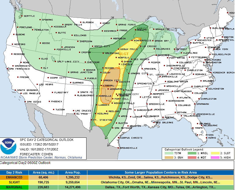
It has been a relatively quiet start to severe weather season in Central Kansas. But that could end on Tuesday.
Late Monday afternoon the National Weather Service Storm Prediction Center upgraded a large area of Central Kansas, including the Salina area, into an enhanced risk. An enhanced risk means that numerous severe storms are possible, along with a potential for wind and hail damage and a few tornadoes.
According to the National Weather Service in Dodge City dangerous severe weather is possible along and east of Highway 283.
A volatile severe weather setup is expected Tuesday, with the highest threat east of a Garden City-Liberal line. The most active period of severe weather is expected 6-11 pm.
Forecasters are expecting scattered supercell thunderstorms, capable of very large hail, damaging wind and tornadoes. Long track strong tornadoes are possible east of Dodge City (east of US Highway 283) Tuesday evening, 7-10 pm.
Residents, particularly east of 283, are urged to review their safety plans, in preparation for Tuesday evening.
(CLICK MAP TO ENLARGE)
]